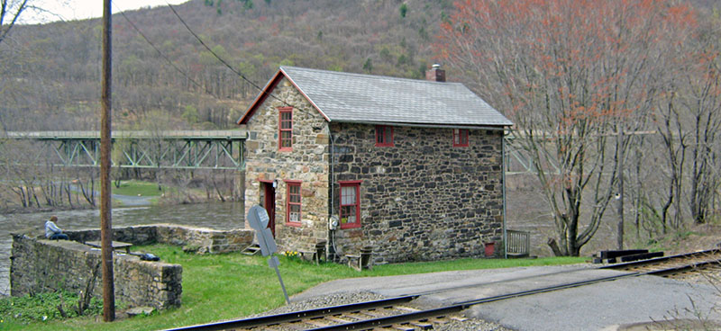
The Lehigh Water Gap Chain Bridge Toll House and East Bridge Abutment has been listed on the National Register of Historic Places as of August 2020. The toll house and the accompanying chain bridge (no longer surviving) were constructed circa 1826 across the Lehigh River in upper Northampton and Lehigh Counties at what was called Weider’s Crossing about ½ mile below the Lehigh Gap proper. Despite the removal the chain bridge itself in 1933, the toll house continues to exist largely intact along with the east abutment of the chain bridge.
Information about the toll house, toll bridge and the surrounding area
- Physical Description
- Historical Significance
- Additional Notes about the Chain Bridge and the surrounding area (PDF)
- Simplified genealogy of the Bauman family (PDF)
Some additional images
- View from the west of the tollhouse showing the remains of the two chain bridge piers in the Lehigh River; photo credit Richard Musselman (2019)
- Chain Bridge at Lehigh Gap, Pa. over Lehigh River. April 1926; Llewellyn N. Edwards (1873-1952); photo credit: Division of Work and Industry, National Museum of American History, Smithsonian Institution
- Photograph showing the chain bridge after its reconstruction after the 1926 fire. The view is looking east across the span; photo credit: Historical Society of Pennsylvania
- View of the burned bridge; this postcard was based on a photograph that appeared in The Morning Call, 30 May 1926
- A Morning Call photo from 1930 shows the immediate area around the chain bridge before construction of the highway bridge (and demolition of the chain bridge).
