![]()
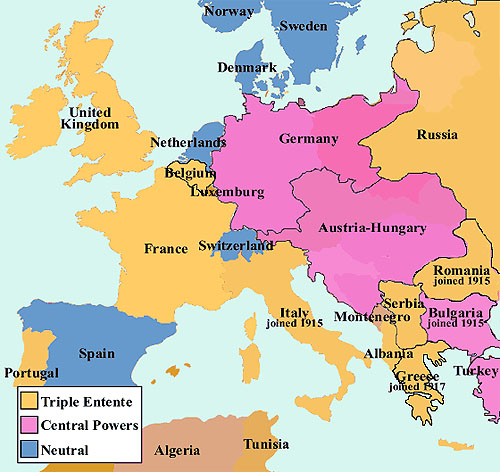
There were several key (and exceptionally thorny) territorial questions that occupied the diplomats at the Paris Peace Conference. And no matter how they chose to redraw boundaries, there were going to be upset people and protests about the end result. There was a great summary of some of these pressing boundary issues in Europe in Current History (April 1919), "Boundary Disputes in Europe: Maze of Difficult and Delicate Problems Confronting the Peace Conference," (*.PDF file) including some maps. Listed below are some of the key territorial issues in Europe and around the world that the diplomats faced in Paris. I hope to eventually get around to explaining what the Conference did (or did not do) in each case.
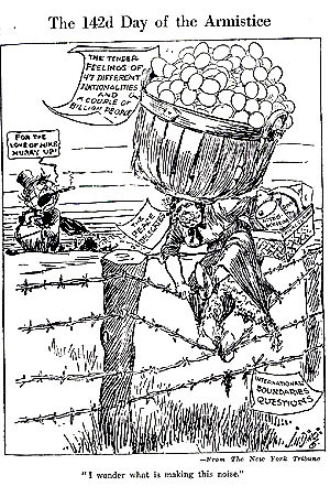
Source for the cartoon is Current History, May 1919
![]()
| Polish Corridor | Saar | Silesia | Rhineland |
![]()
| Memel | South Tyrol | Sudetenland | Shanghai |
| Thrace | Fiume | Asia Minor | Transylvania |
| Cyprus | Heligoland | Albania | Ukraine |
| Shantung | Ipek circumspection | Sanjak of Alexandretta | Strumitsa Enclave |
![]()
| Austria | Hungary | Czechoslovakia | Yugoslavia |
| Poland | Estonia | Latvia | Lithuania |
| Turkey |
![]()
Suggested Reading
Suitors and Suppliants: The Little Nations at Versailles by Stephen Bonsal (1946)