Maps
These thumbnails are clickable and will load a larger version of the image.
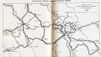
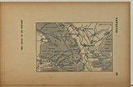
Map of the major routes (highways) of the Verdun region (source: Verdun, Argonne, Metz, Michelin Battlefield Guide, 1919)
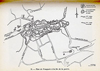
Map of the butte of Vauquois showing the mine explosions (source: André Pézard, Nous autres à Vauquois, 1918 (1974))
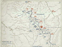
Map of the Battle of the Frontiers, August 1914 (source: www.firstworldwar.com) This map allows you to place the Verdun-Vauquois region in the context of the start of the war.
Map of the Vauquois area (source: Atlas de Poche du Théâtre de la Guerre, 1915-link below)
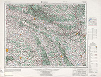
Map of the entire Reims region in Eastern France (source: Army Map Service, 1955--link below) Look for the arrow pointing at Vauquois.
There are not too many detailed World War I maps that are available online in a digital format.
- Atlas de Poche du Théâtre de la Guerre. 56 cartes. Larousse (Paris). 1915 (See page 18 (screen 22/65) for Vauquois.)
- Photographie aérienne française de la Butte de Vauquois prise à 300 mètres d’altitude le 21 août 1917 (nice aerial overview)
- Cartographie 1914 - 1918: Le front ouest de la première guerre mondiale (You can click on any calendar date and see a map of the western front. For example, here is the map for 7 November 1914.)
- Army Map Service, 1:250,000, NM-31-9, Reims, France (1955) includes Verdun and Vauquois
- Battlefield Maps - Western Front
- Campaign Atlas to the Great War (West Point)
- Maps & Battles of World War I
- The Perry-Castañeda Library Map Collection has many maps of France, but little relevant to World War I.
- Trenches on the Web, The Map Room
- Wikimedia Commons Atlas of World War 1
- Yale University Library
- ArcGIS topographic map (search for Vauquois)
- USGS Historical Topographic Map Explorer (search for Vauquois)
